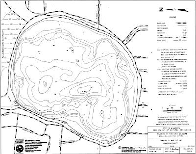
DNR map of Lake Harriet
The Minnesota DNR publishes a bottom contour map of Lake Harriet. Although not really intended for ship navigation, it shows good anchorage locations and is handy to have on-board. It also shows that unlike Lake Calhoun, Lake Harriet is uniformly deep, and that means that is is mostly free of the nasty Milfoil that plagues its sister lake. The full-size map in PDF format is HERE.
FYI, a map of Lake Calhoun is HERE.
If you own a Garmin handheld GPS and are interested in a FREE depth chart of the lakes, be sure to see this post HERE.


Do you have the lat/long coords for those three cans?
ReplyDeleteI'll record them the next time I go out, and post them, them unless someone beats me to it.
ReplyDeleteRelated to another post I made - if you are interested in a lake map with community generated content (community placed water hazards, fishing holes, boat launches, etc), check out www.fishnbudz.com
ReplyDeleteThank You and I have a tremendous provide: Whole Home Renovation Cost house and renovation show
ReplyDelete